
the atchafalaya basin - river of trees

The Atchafalaya Basin, home of North America's last great river swamp, is the basin of the Atchafalaya River, a 135-mile long natural distributary of the Mississippi River that empties into the Gulf of Mexico and is the only growing delta in Louisiana. The Basin includes some 1.4 million acres. Situated at the mouth of North America's most important flyaway, the Basin supports half of America's migratory waterfowl (more than 300 bird species) and provides the most important habitat for neotropical migratory land birds in the Western Hemisphere.
The Basin can be divided into three distinct areas: (1) the upper part of the Basin, which is composed of the largest contiguous bottomland hardwood forest in North America; (2) the middle portion, which is composed of the largest cypress-tupelo swamps on the continent; and (3) the lower area, which contains freshwater and brackish marsh. The most ecologically vital parts of the Atchafalaya Basin include some 885,000 acres of forested Wetlands and 517,000 acres of marshland.
Nearly the entire eastern North American population of neotropical birds, and much of the western continent, migrate from Yucatan through coastal Louisiana and the Atchafalaya Basin. Containing the largest wetland forest in North America, the Basin provides critical habitat for these, and many other, important unique species.
The largest river swamp in North America, the Atchafalaya Basin may be one of the last refuges for such endangered species as the peregrine falcon, the Florida panther, Bachman's warbler and the ivory-billed woodpecker. Approximately 100 species of fish and shellfish support sport and commercial fishing and feed birds, reptiles and mammals. Other animals that call the Atchafalaya home include the Louisiana black bear, white-tailed deer, bobcat, coyote, alligator, beaver, nutria, mink, otter, muskrat, armadillo, fox and opossum. Overall, the Atchafalaya Basin is home to eight federal and state listed endangered/threatened wildlife species, six endangered/threatened bird species, as well as twenty-nine rookeries, over forty mammalian species, over forty reptile species and more than twenty amphibian species.
The Atchafalaya is also considered the most productive swamp in the world and is estimated to be three to five times more productive than the Everglades and the Okefenokee Swamp. Approximately 90% of wild crawfish sold in Louisiana come from the Atchafalaya Basin. This productivity enables the Basin to provide the last bastion for swamp-based Cajun culture in the U.S. and is vital to the livelihoods and heritage of local Cajun fishing communities who harvest fish and seafood that is sold across Louisiana and the U.S.
The Basin's cypress swamps are adapted to withstand severe weather events, providing a buffer to slow storm surges from hurricanes and tropical storms. The Basin is also managed by the Corps of Engineers (Corps) as a critically important spillway with the capacity to absorb immense quantities of water and protect South Louisiana and much of the Lower Mississippi River Valley from major Mississippi River floods.
THE ATCHAFALAYA BASIN - FLOOD PROTECTION
The Basin is designed to pass the Project Flood, which is a flow of 1,500,000 cubic feet per second. By 1982, the Atchafalaya Basin could only pass 840,000 cubic feet per second (57%) despite the levees being raised after the 1973 flood. Today, the situation is significantly worse, the Bayou Sorrel Locks are 8.5 ft. below the height of the levees, and no one knows what percentage of the Project Flood it can pass. To make things worse, the Mississippi River bed is higher, so in 2011 the water was cascading by several inches over the Morganza spillway structure, which is not high enough anymore.
As it is right now, the levees will fail. For us to understand what the consequences will be, we can look at the 1927 flood, before the levees were built, with the understanding that the Project Flood will be almost 30% larger than the 1927 flood, and the Basin already lost much of its flood capacity, so the flood will be much, much worse. In 1927, the flood reached all the way to Lafayette. St Martin, Iberia and St Mary parishes were completely under water. The only thing above water were the ridges of Bayou Teche. Large parts of St Landry parish were also under water. On the eastern part, parts of Baton Rouge were under water as was much of Pointe Coupee, Iberville and Assumption parishes. The Project Flood, most likely, will flood everything between the Atchafalaya and Mississippi levees, including chemical plants like Air Products, Dow Chemical and Syntech.
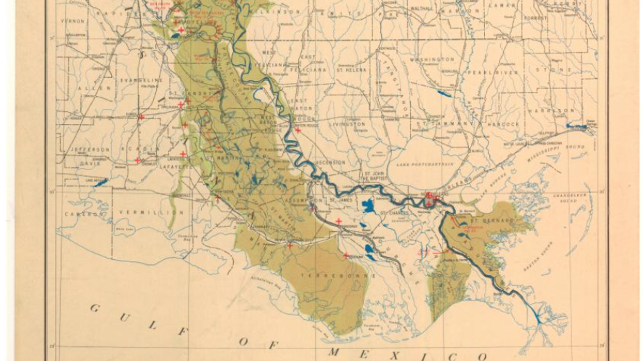
1927 Flood
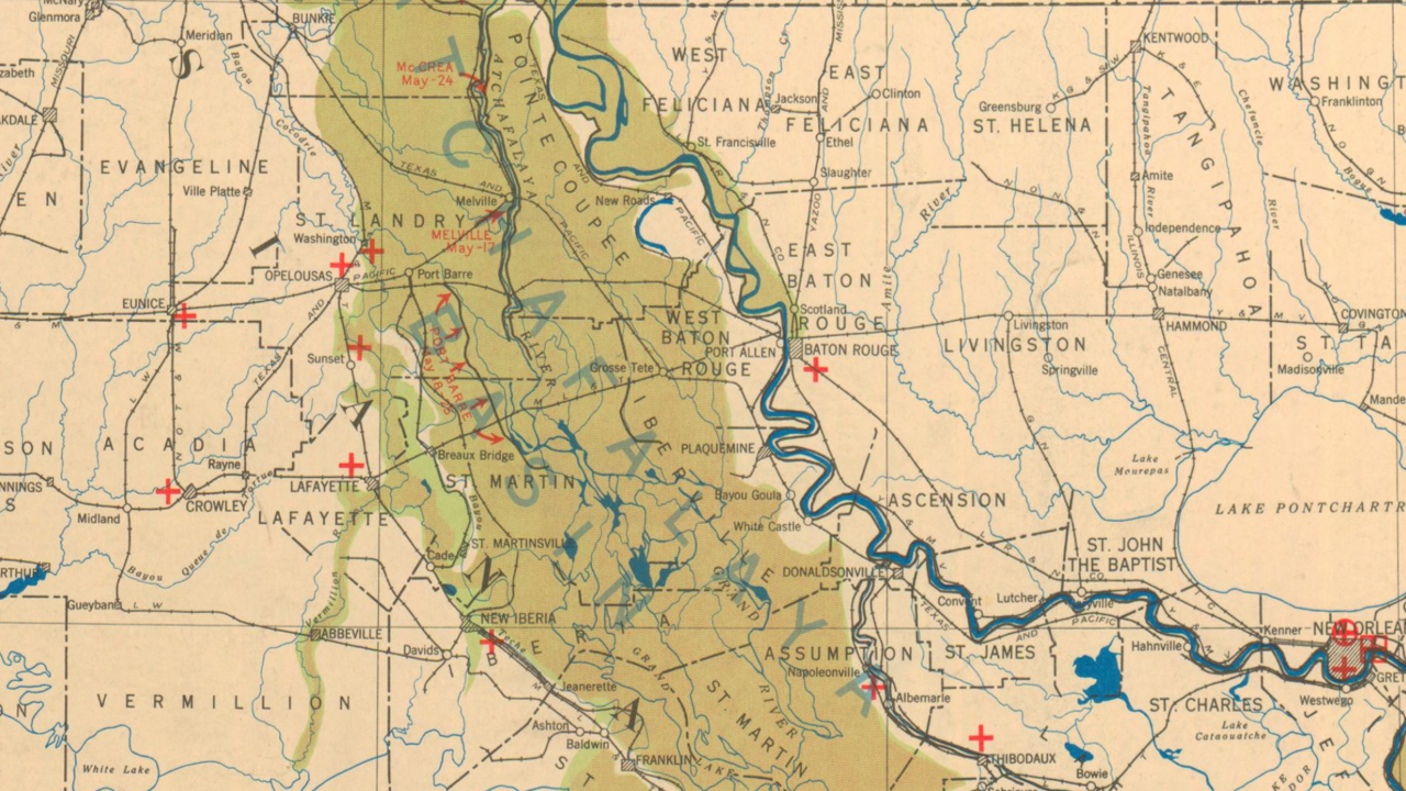
Much of St Landry, St Martin, and Iberia parishes were flooded.
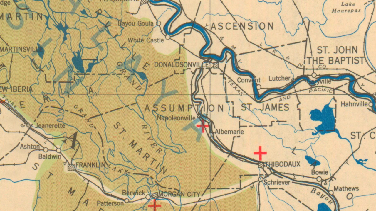
Only the ridges of Bayou Teche were above flood water in 1927.
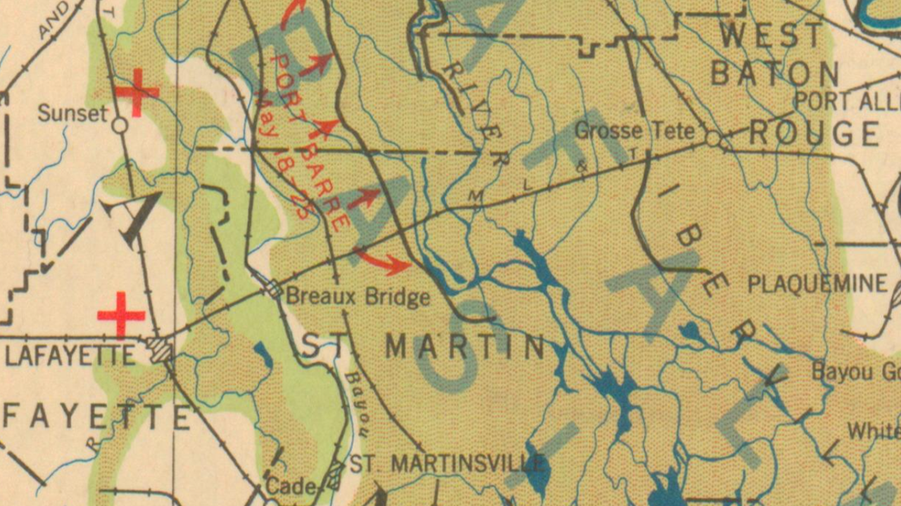
The flood reached the city of Lafayette, which was small at the time but has since expanded south into areas that flooded in 1927.